









How Drone Solar Inspection Enhances Efficiency and Accuracy in Utility-Scale Solar Panel Maintenance
Understanding Drone Solar Inspection: Technologies and Data Collection Methods
Drone solar inspection utilizes professional drones equipped with multispectral sensors, primarily high-resolution RGB cameras and thermal infrared (IR) sensors, to collect detailed performance data on solar panels across utility-scale solar farms. Typical thermal sensors provide spatial resolution around 640×512 pixels and can detect temperature differences as low as 0.05°C, enabling identification of panel hotspots and thermal anomalies. RGB cameras generally capture imagery at resolutions exceeding 20 megapixels for precise defect visualization.
Flight duration for commercial drones used in solar inspection ranges from 20 to 35 minutes per battery cycle, influencing operational planning to ensure complete coverage of large installations such as those exceeding 10 MW capacity. Flight paths are preprogrammed using GPS-enabled waypoint navigation to enable systematic data collection and repeatability necessary for temporal performance monitoring across your portfolio.
Compared to manual solar panel inspections, drone inspection reduces total survey time by up to 75% while increasing data granularity. Manual methods require field personnel to physically access array rows for visual and handheld thermography checks, often missing localized defects due to limited vantage points. Drone inspection circumvents these limitations by acquiring orthomosaic thermal and RGB images from aerial perspectives, capturing the full PV array efficiently.
Effective data collection incorporates onsite sensor calibration using blackbody references or ambient temperature baselines to enhance thermography accuracy. Environmental conditions such as ambient temperature, solar irradiance above 600 W/m², and stable wind below 5 m/s are requisites to maintain data consistency. Post-flight, captured datasets are transferred to inspection software for orthomosaic stitching, thermal-normalized correction, and georeferencing to facilitate spatially precise defect localization.
Key Components and Software in Drone Solar Inspection Workflows
Inspection software solutions are integral to converting raw drone data into actionable intelligence. Platforms such as DroneDeploy, Pix4D, or proprietary agrivoltaic-tailored software stitch thousands of individual images into georeferenced orthomosaics with spatial accuracy within 3–5 cm, enabling precise panel-by-panel analysis. Thermal and optical data integration allows for composite maps that highlight anomalies not visible in either dataset alone.
Advanced inspection software leverages machine learning algorithms to conduct automated defect detection by analyzing temperature disparities exceeding 5°C, irregular visual patterns, and pixel-level anomalies. These algorithms identify faults such as hotspots, cell mismatches, microcracks, soiling, delamination, and string faults. AI analytic models continuously improve via retraining on validated inspection datasets collected across portfolios containing multiple utility-scale projects.
Cloud-based data management systems enable centralized storage and access to inspection results, integrating with asset lifecycle management platforms to track maintenance records, operational status, and performance trends. This integration supports uniform maintenance scheduling, budget forecasting, and condition-based intervention planning across diverse solar power assets distributed regionally or internationally.
Inspection Protocols and Standards Guiding Drone Solar Inspections in Utility-Scale Plants
Drone-based thermal inspections adhere to international and regional standards to assure data validity and comparability. IEC 62446-3:2020 specifies criteria for thermal imaging in PV system inspections, mandating calibration, inspection conditions, and defect classification protocols. Inspections should be conducted under stable irradiance exceeding 600 W/m² and ambient temperatures between 15°C and 35°C to ensure thermal contrast accuracy.
Drone solar inspections are complemented by electrical parameter verification, including inverter performance, string voltage balancing, and insulation resistance testing, typically executed by stationary equipment or handheld testers. These measures confirm the operational integrity suggested by thermographic data.
For utility-scale solar farms exceeding 10 MW, bi-annual drone inspections timed at spring and autumn are recommended to track seasonal degradation while minimizing operational disruption. These inspections enable early detection of panel degradation, supporting proactive maintenance to extend system lifetime and optimize yearly energy yield.
Drone operations comply with aviation regulations such as EASA Part-UAS in the EU or FAA Part 107 in the US. Pilot certification, pre-flight risk assessments, and approved flight corridors near solar farms govern operational safety. Measures include maintaining minimum distances from infrastructure and avoiding exposure to sensitive airspace to mitigate risks to personnel and equipment.
Analyzing Common Solar Panel Defects Detectable by Drone Inspections
Drone solar inspection excels at identifying several defect classes impacting solar panel efficiency. Hotspots, caused by partial shading, solder joint failures, or cell mismatches, exhibit temperature elevations typically exceeding 5°C above panel average and can lead to accelerated module degradation.
Microcracks and delamination, often submillimeter and difficult to detect visually, degrade electrical pathways and reduce cell irradiance absorption. High-resolution thermal sensors detect these defects indirectly by highlighting localized thermal anomalies associated with impaired cells during operation.
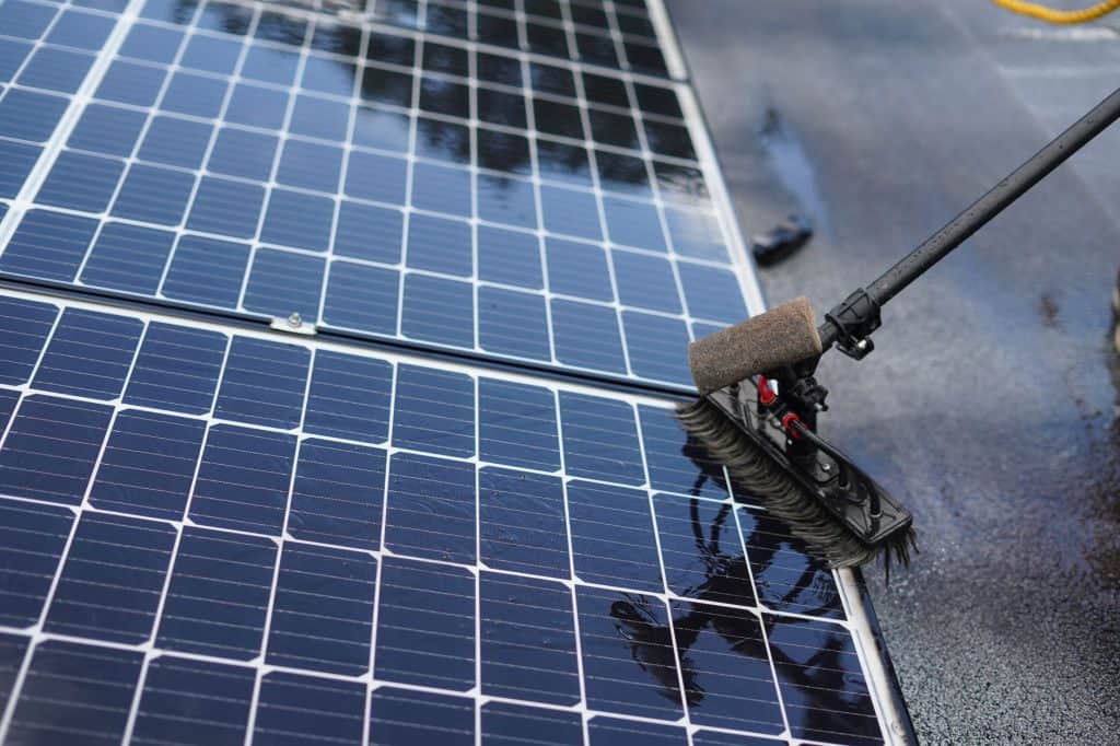
Soiling from dust accumulation, pollution, bird droppings, or nearby vegetation produces non-uniform cooling patterns detectable as cooler thermal patches compared to clean areas. Correlating these patterns with production data identifies soiled panels that most critically benefit from cleaning intervention.
Drone inspection analytics quantify defect severity by calculating hotspot size, temperature differential magnitude, and affected panel percentage. Maintenance prioritization is based on estimated energy yield loss, allowing resource allocation to repairs or cleaning activities with the highest return on investment.
Optimizing Solar Asset Performance Through Periodic Drone Inspections and Data Analytics
Integration of drone inspection data into the asset lifecycle management framework enables dynamic, condition-based maintenance planning. Inspection outputs classify panels by defect types and severity, facilitating scheduling of preventive cleaning, module replacement, or string rewiring before failure events.
Real-time or near-real-time analyses enabled by automated inspection software reduce response times to emerging faults, shortening downtime from weeks under traditional scheduled maintenance to days, enhancing overall elektrownia słoneczna availability.
Case studies in utility-scale assets report yield recoveries between 3-7% following drone-guided maintenance, specifically through hotspot remediation and improved cleaning schedules guided by thermographic insights.
Portfolio-level management benefits from aggregating inspection data across multiple solar installations. Cloud data platforms deliver dashboards summarizing asset condition indices, enabling cross-project scheduling alignment and balanced budget distribution for maintenance efforts.
Drone inspections have demonstrated a 20-30% reduction in unscheduled downtime relative to manual inspection regimes by enabling earlier fault detection and more efficient resource deployment.
Challenges and Limitations of Drone Solar Inspection in Agrivoltaic and Community Solar Projects
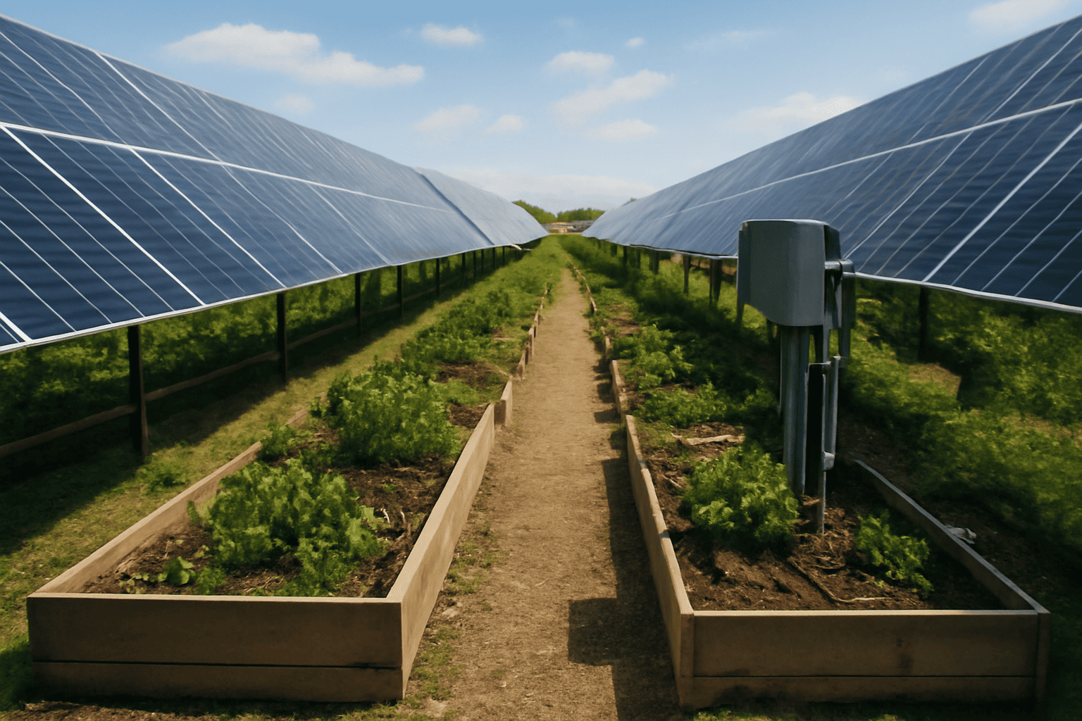
Agrivoltaic systems, such as those combining solar panels with active agriculture or community gardens, present imaging challenges including canopy shadows, variable ground cover reflectance, and intermittent shading. These factors degrade thermal and RGB data quality, generating signal noise and complicating defect differentiation.
In community solar projects similar to Solar Plus Garden, drone flight permissions are often constrained by local airspace rules, privacy considerations, and urban proximity. These restrictions limit flight altitude, time windows, and inspection frequency, typically reducing operational capacity to quarterly surveys.
Environmental conditions critical to drone inspection accuracy include wind speeds below 5 m/s to maintain image stability and solar irradiance levels above 600 W/m² to create sufficient thermal contrast. Sun angle variation throughout the day affects shadow patterns and thermal readings, necessitating standardized flight scheduling within 3 hours of solar noon.
Inspection software addresses these challenges by applying multi-temporal image differencing, algorithmic noise filtering, and manual analyst review to validate findings. These mitigations maintain data reliability despite agrivoltaic complexity and community solar constraints.
Integrating Drone Solar Inspections into Solar Plus Garden’s Investment and Membership Framework
Solar Plus Garden incorporates drone solar inspection into its transparency framework, providing investors in its 10 MW utility-scale project with detailed operational reports to demonstrate asset performance and maintenance rigor. These reports document inspection frequency, detected anomalies, and corrective actions, supporting informed investment decisions.
Inspection analytics directly influence członkostwo w społeczności benefits by informing maintenance budgeting, which is partially funded through membership fees and solar revenue streams. This linkage ensures asset care aligns with real-time condition data while financially sustaining community activities including garden operations.
Drone inspection updates are regularly communicated to Garden members through data portals and summary reports, strengthening community engagement and stakeholder stewardship within the Solar Plus Garden ecosystem.
Operational stability verified by drone data underpins quality assurance for associated agrivoltaic cultivation, connecting renewable energy generation to regenerative agriculture outputs, a core aspect of Solar Plus Garden’s value proposition.
Często zadawane pytania
- How often should drone solar inspections be conducted on a utility-scale solar farm?
- For utility-scale solar farms of 10 MW and above, bi-annual drone solar inspections timed around seasonal transitions are recommended to detect defects early and optimize asset performance, subject to site-specific conditions and regulatory environments.
- What types of solar panel issues are most effectively detected by drone thermographic inspections?
- Drone thermography is effective at identifying hotspots, microcracks, soiling-related cooling anomalies, shading effects, and electrical connection faults by analyzing surface temperature patterns and deviations in thermal imagery.
- Can drone inspections replace manual solar panel inspections entirely?
- Drone inspections significantly improve data collection speed and spatial coverage but do not fully replace manual inspections that require physical electrical testing or panel access for repairs. They serve as a complementary method to optimize inspection resources.
- How does Solar Plus Garden use drone inspection data in its community membership and investment models?
- Solar Plus Garden integrates drone inspection data into its investment reporting and asset lifecycle management, enabling transparent communication with investors and community members, while guiding maintenance funding allocation based on actual asset condition.
Wniosek
Drone solar inspection represents a precise and efficient approach to monitoring and maintaining utility-scale solar panels such as those in Solar Plus Garden’s 10 MW project. Employing professional drones with thermal and optical sensors, combined with advanced inspection software and analytics, enables early fault detection, reduced downtime, and improved energy output. Integration of inspection data into asset lifecycle management and community membership frameworks promotes transparency, financial sustainability, and operational excellence. Ongoing developments in drone inspection technology and evolving regulatory conditions necessitate continuous adaptation of inspection strategies to maintain optimal solar power portfolio performance.
Powiązane lektury
- Maximizing Solar Panel Efficiency: A Practical Guide to Solar Maintenance and Cleaning
- Optymalizacja czystej energii: jak integracja energii słonecznej z kogeneracją i systemami BESS zwiększa niezawodność i wydajność
- Mastering Solar Project Management: Effective Strategies for Utility-Scale Solar Development